
M. Wiegmann, K. Koll & J. Aberle
2025 - 2027
Support Program NEOG, Lower Saxony State Agency for Water Management, Coastal and Nature Conservation
Department of Water and Circular Economy at Magdeburg University
House of Science

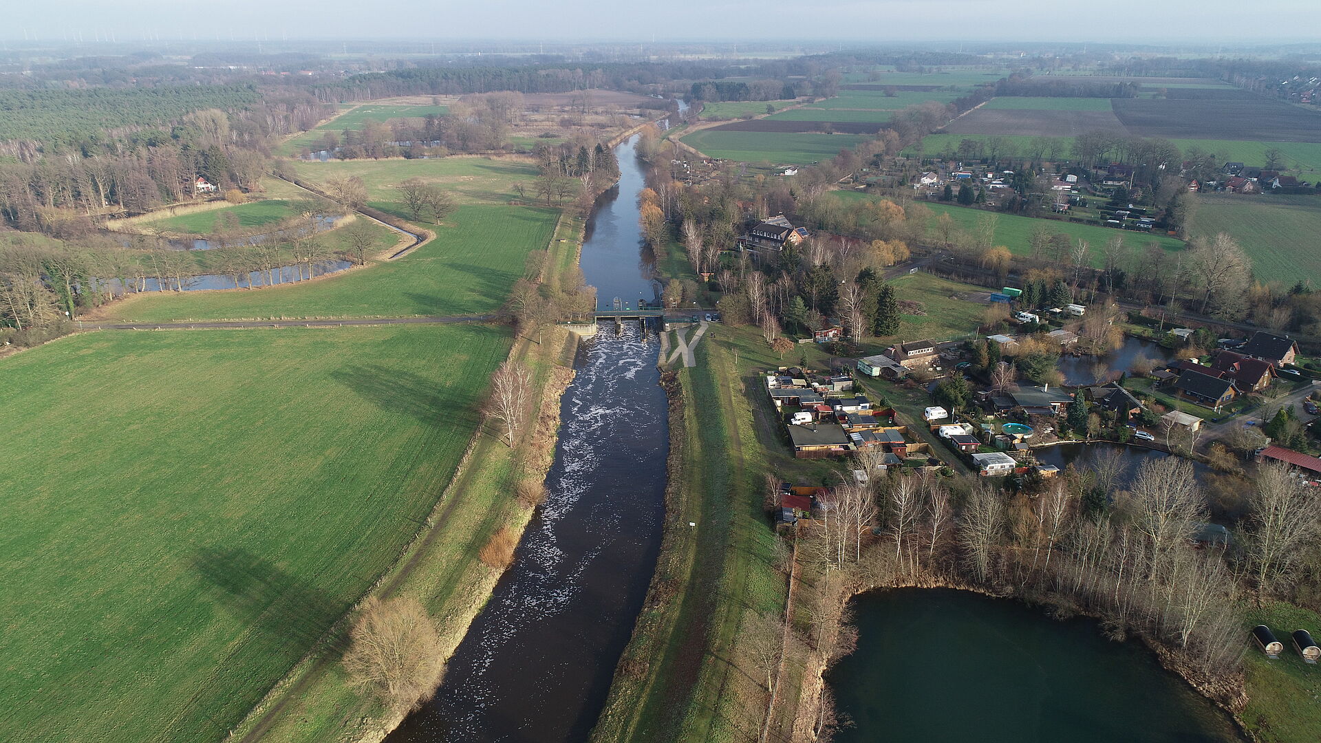
An interdisciplinary consortium of scientific and institutional partners is researching strategies for the nature-based development of mid-sized rivers to make them more climate-resilient in the long term.
"Worldwide, rivers have been straightened and expanded to improve flood protection or, for example, to make them usable for agricultural land use in the surrounding areas. These interventions have led to a significant loss of natural river structures and habitats."
In addition, the natural dynamics of waterways are heavily restricted in many areas due to land being used for flood protection measures or agricultural purposes. Only 9% of flowing waters in Germany (3% in Lower Saxony) currently meet the good ecological status required by the EU Water Framework Directive (WFD). At the same time, extreme weather events like droughts and floods, which occur more often due to climate change, pose major challenges for water management. This is where the research project 'KliGeW' comes in. The goal is to identify new measures for sustainable and ecological water management development of waterways and the landscape water balance in Lower Saxony.
The Central Alps serve as a model region for this. The project looks into the concept of 'mushroom landscapes' to improve the natural water absorption and storage capacity of river areas, make waterways more natural and therefore more ecologically valuable, and boost resilience against extreme events like floods and droughts.“ – Press release, House of Science (May 13, 2025)
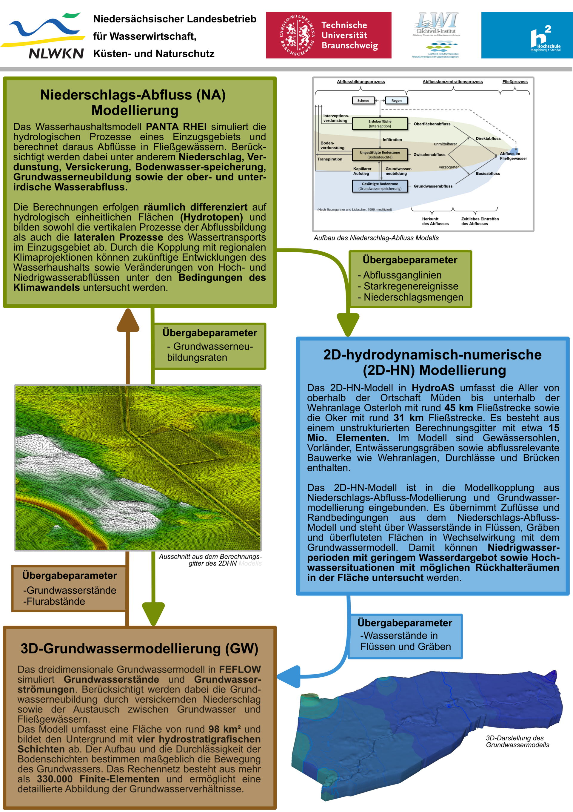
The first project phase focuses on simulating the water balance within the project area with the aim of being able to assess the impacts of measures in and around the water. The water balance is represented by three separate but interconnected sub-models.
Precipitation-Runoff Modeling
The NA modeling describes the conversion of rainfall into runoff within a catchment area. Using rainfall, terrain, and land use data, runoff amounts and water levels can be simulated, and hydrological processes can be better understood. The NA model provides important input for the groundwater model and the 2D-HN model in the project, so it’s at the start of the modeling chain.
2D hydrodynamic numerical modeling
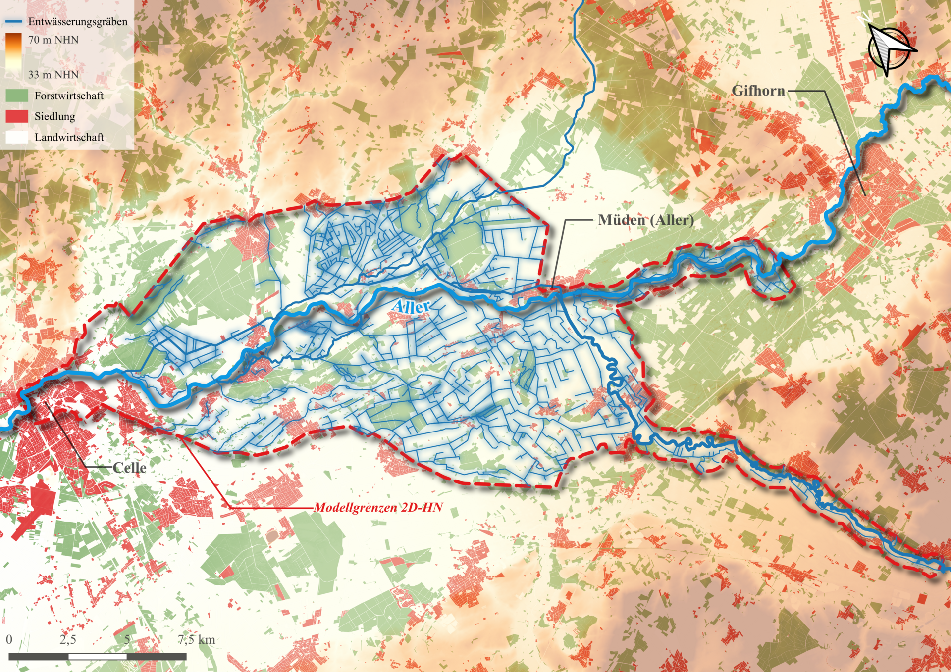
The 2D-HN model simulates water levels, flow speeds, and flow paths in the study area. In the KliGeW project, it's used to show surface runoff in the Mittelaller study area to identify possible retention areas in fields, ditches, and along water bodies. The 2D-HN model acts as the hydraulic link between rainfall-runoff modeling and groundwater modeling. It takes inflows, rainfall, and other boundary conditions from the NA model and provides water levels in rivers and ditches for the groundwater modeling.
3D groundwater modeling
The groundwater model represents the movement and storage of water underground in a model. Based on geological, hydrological, and hydrogeological data, groundwater levels, flow directions, and the effects of different management and climate scenarios can be examined. For the calculations, input parameters from other models are taken into account, for example, water levels in rivers or the spatially distributed groundwater recharge in the catchment area.